Video and pictures: Flash flooding hits Shropshire again as 'twister' appears over Shrewsbury
Heavy and sporadic rain in Shropshire caused flash flooding in a number of areas today, with drivers rescued from vehicles and roads closed.
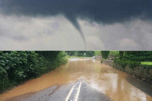
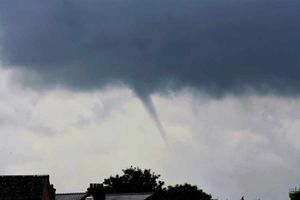
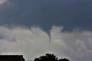
One Shropshire Star reader also captured pictures of what appeared to be a funnel cloud in Shrewsbury.
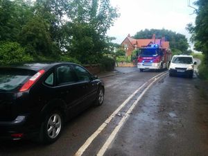
A fire crew from Newport was dispatched to Wellington Road at Honnington at around 12.50pm where police had already helped a driver from his car.
A diversion was put up in a bid to prevent any more drivers becoming stranded.
Officers tweeted:
Three homes in Ewart Road, Telford, were flooded at around 12.12pm, when storm water became backed up in blocked drains. Fire officers used portable pumps to alleviate the flooding while Severn Trent was asked to investigate the blockage.
A home at Royal Oak Drive, Telford, was also affected by the rain, with flooding casing problems with the electrics.
Telford fire crews were called out to help with flash flooding in Donnington. They tweeted:
A video of flooding in Lognor was tweeted by @think_idea:
Telford & Wrekin Council reported flooding issues in Ketley, Donnington and Wellington:
Shropshire Council tweeted:
Today's downpours follow flash flooding on a road in Telford last week which left residents trapped in their gardens and caused part of a store's roof to "cave in".
Meanwhile, a Shrewsbury man captured photos of a funnel cloud over the county town today.
Matthew Hancox took a series of photos of the "twister" over Shrewsbury rooftops this morning. The clouds become tornados when they come into contact with the ground.
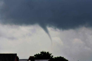
Mr Hancox, 37, of Greenfield Gardens, Coton Hill, said he had been surprised to see the cloud last so long.
He said: "I am a bit of a fan of unusual weather and I just happened to be on the computer and could see something out of the corner of my eye and thought "that was strange".
"I went to the window to have a look at it, normally you see them and they disappear within five seconds but this carried on. I looked away and looked back and it seemed to get longer so I grabbed my camera and took some snaps.
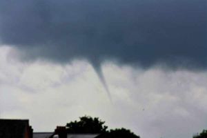
"From the moment I saw it to the moment it disappeared was about five minutes. It was moving very very slowly right to left in the Wellington direction. "
Mr Hancox said it looked as if the cloud was over the Sutton Farm area of the town.
Graham Madge, a spokesman for the Met Office, said the unsettled weather conditions could continue for the next few days.
He also explained what caused the sudden change from heat and sunshine, to flash floods and funnel clouds.
"It is a little like a saucepan that is boiling. You get these bubbles coming up which is where the heat is causing the air to rise. The air becomes quite unstable and the instability of the atmosphere causes these large clouds to develop which can release quite an extreme amount of rainfall very quickly," he said.
"Sometimes these systems can develop in just an hour and unleash quite a lot of water in a small area and overwhelm drainage systems and lead to flooding which can in some situations be quite serious."
He added: "It is not unknown to get tornados in the UK. They are an annual event but not of the severity you would expect in the Mid West of the US. But they are are a reasonable occurrence and they can develop in conditions for thunderstorms."
Mr Madge said that yellow weather warnings remain in place for today and Thursday but that conditions are expected to brighten up at the weekend.
Later Wroxeter Vineyard tweeted:


