River Severn flooding: Full list of closed roads in Shrewsbury, Ironbridge and Bridgnorth
The River Severn is now thought to have peaked at all key areas in Shropshire just short of its all-time record highs.
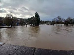
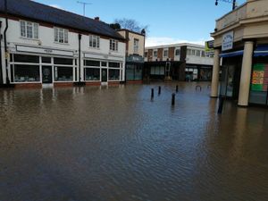
Many riverside areas across the county are still submerged, although water levels have started to drop across the county.
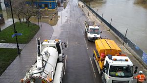
At Shrewsbury levels are down nearly half a metre with new photos showing how much clearer Smithfield Road and Wyle Cop are compared to Tuesday.
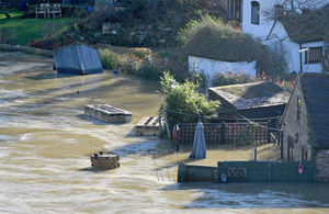
Meanwhile the river level peaked at Ironbridge shortly before midnight without overwhelming the barrier, though the level has barely dropped in the hours since then and the severe 'danger to life' flood warning remains in place.
The River Severn has also peaked at Bridgnorth where levels are also starting to go down.
Shropshire road closures
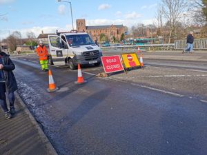
Despite water levels starting to go back down, a number of roads in all three towns are still closed.
Shrewsbury
Gravel Hill Lane
Longden Coleham
Coleham Head
Smithfield Road
Coton Hill
Chester Street/Cross Street
Sydney Avenue
Atcham to Cross Houses and Chiltern Farm Lane
Coleham Head Lane Closure into Town Centre
Berwick Road
Old Coleham
Victoria Avenue
Williams Way
Raven Meadows at the Roushill side
Roushill
Cressage to Eaton Constantine
Atcham to Berwick Wharf
B4380 Shrewsbury to Atcham
Castle Foregate and English Bridge reopened to traffic at around 2pm on Wednesday.
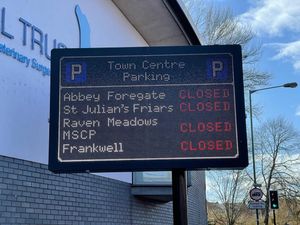
The Frankside Main, St Julian’s Friar’s, Raven Meadows multi-storey and Abbey Foregate car parks are all closed until further notice, while Frankwell Riverside is closed for the Environment Agency to use.
Three footpaths in Shrewsbury are also closed. They are:
Greyfriars Bridge to The Weir
The Pig trough to West Midland Showground
New Street to The Stew/Frankwell Riverside Car Park
Ironbridge
The Wharfage (and car park)
Buildwas Road
Dale End (and car park)
Coalford
Ferry Road
Waterloo Street reopened on Wednesday afternoon.
Dale End and The Wharfage car parks are also closed, while Madeley Road has reopened with temporary traffic lights.
Bridgnorth
Southwell Riverside
Severnside South Road and The Boat Yard
Doctors Lane
Severn Terrace
Quayside
Riverside and Friars Street
A442 – Telford to Bridgnorth (Upstream of Bridgnorth and Fort Pendlestone)
A442 – between Sutton Maddock island and Bandon Arms island
Riverside and Riverside West elevated car parks are closed, and displaced permit holders with a valid permit can use Innage Lane Car Park or Severn Street Car Park.
The footpath from Bylet to Wellmeadow is also shut.
Public transport in Shropshire
Shrewsbury buses
Shrewsbury bus station also remains closed. Temporary bus terminus drop off/pick up points have been set up at:
New Park Road near Beacalls Lane
Outside Theatre Severn
Abbey Foregate
Shropshire Council is urging anyone planning to visit Shrewsbury town centre to use the park and ride with the main town centre car parks closed.
Ironbridge buses
Bus services 8 & 18 are serving Madeley as normal then diverting via the Ironbridge bypass direct to Much Wenlock. They are not serving Ironbridge Gorge as the Lloyds is flooded and the section from the bottom of Madeley Bank is closed. There is no service to Jackfield.
Service 19 is currently diverting after Lightmoor via the Lawley bypass and M54/A5 due to B4380 flooded at Atcham.
Shops

Shrewsbury's Darwin Centre has opened this morning but the council advice to use park and ride services remains because of all the closed roads.
In Ironbridge all Wharfage businesses are temporarily closed.
Flood reception centre
The council opened a flood reception centre in Bridgnorth at 9am at Castle Hall, West Castle Street. They will offer advice and support to those who need it.

