Cold weather payments triggered in Shropshire as freeze forecast to last for at least a week
An MP has welcomed cold weather payments to vulnerable residents as the current freeze is forecast to last at least a week.

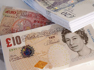
Cold Weather Payments of £25 are paid to recipients of selected benefits when the average temperature is recorded of forecast to be 0C or below for seven consecutive days.
South Shropshire MP Philip Dunne said: “The cold weather forecast for the next few days has triggered Cold Weather Payments of £25 for those eligible on selected benefits, helping to cover the additional cost of heating.
"Cold Weather Payments are made automatically to those eligible, so there is no need to apply.”
Postcodes affected in Mr Dunne's constituency from November 28 to December 4 are SY5, SY6, TF11, TF12, TF13, TF7 and TF8.
Cold weather payments may be made to recipients of Pension Credit, Income Support, income-based Jobseeker’s Allowance (JSA), income-related Employment and Support Allowance (ESA), Universal Credit or Support for Mortgage Interest.
The Met Office says that with the UK sitting in cold air from Scandinavia, the weather is turning much colder for the rest of this week and the start of next - with daytime temperatures struggling to get above single figures and overnight temperatures staying below freezing for much of the country.
They say the cold regime looks likely to continue into next week, with a good deal of dry sunny weather for many. However, showers remain possible, particularly in eastern coastal areas, and these could be wintry at times.
The Shropshire region is not currently covered by any weather warnings from the Met Office.
But in the rest of the country temperatures have plunged to a low of -7.2C in England as snow fell in Scotland, Northumberland and Yorkshire, but the Met Office has said it is too early to predict a white Christmas.
Swathes of Scotland, England and Ireland were warned to brace themselves for snow and ice, with weather warnings issued amid plummeting temperatures.
The forecaster said the three lowest temperatures recorded at its observation sites overnight were all in Cumbria on Wednesday, with a low of -7.2C in Bridgefoot, -6.5C in Shap and -6.1C in Keswick.
Met Office spokeswoman Nicola Maxey said it has recorded snow in eastern Scotland, Northumberland and Yorkshire, with about 2cm of snow in some eastern coast areas and 5cm at Fylingdales on the North York Moors.
Daytime temperatures are expected to drop to single-digit figures this week and night temperatures are expected to stay below freezing for large parts of England and Scotland.
One yellow warning, covering areas in north-east England, the east Midlands, the east of England, Yorkshire and Humber and parts of Scotland, will be active from 5pm on Thursday until 11am on Friday.
Another, affecting Cornwall, Devon, Dorset and Somerset, will be in place from 3am to 4pm on Thursday.
Motoring organisation RAC urged drivers to "ensure they're winter-ready as some get their first real taste of snow and ice", while the forecaster warned that wintry conditions could lead to icy patches on untreated roads, pavements and cycle paths, possibly leading to some longer journey times.
Ladbrokes' latest betting odds for snow to fall anywhere in the UK on Christmas Day are 1/2, and it says Edinburgh and Newcastle are the "most likely destinations to see snow".
But the Met Office urged people to take a prediction this far in advance with a "pinch of salt".
Ms Maxey added: "Christmas is still a month away, so it is impossible with this lead time to have any confidence in a detailed forecast.
"There is often a fine line between who sees snow and who sees rain. Sometimes just a fraction of a degree Celsius change in temperature can make the difference between rain or snow falling, making forecasting snow weeks in advance extremely difficult.
"The definition of a white Christmas most widely used is for a single snowflake to be observed falling in the 24 hours of December 25.
"Therefore, snow falls 'somewhere' in the UK for more Christmas days than not. But widespread snow falling and lying on the ground is rather more infrequent.
"For widespread and substantial snow on the ground on Christmas Day we have to go back to 2010.
"There was a cluster of a few really cold Christmases in the 1830s and early 1840s that preceded the publication of a Christmas Carol by Dickens in 1843, maybe contributing to our ongoing national association of snow and Christmas.
"Christmas comes at the beginning of the season for snow. Wintry weather is more likely in the deepening cold of early January."
Whatever happens this winter, residents in Shropshire will be hoping that there is no repeat of what happened in Newport (Salop) on January 10, 1982 when a bone-chilling temperature of -26.1C was recorded. It is the lowest daily minimum temperature recorded in England.
RAF Shawbury is also up there in the list of Shropshire in the deep freeze when the weather station recorded the third coldest temperature in separate cold spells since 1961, when the mercury plunged to -25.2C in December 1981.
According to Met Office data, Shropshire is only frozen out by the -27.2C thermometer challengers recorded at Braemar and Altnaharra in Scotland in January 1982 and December 1995 respectively.


