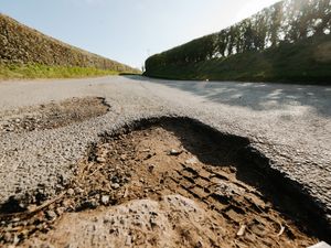
Flooding and high winds batter Shropshire with Severn still yet to peak
Storm Eunice's siege of Shropshire and Mid Wales is far from over, with flood barriers braced for high water levels all along the Severn.
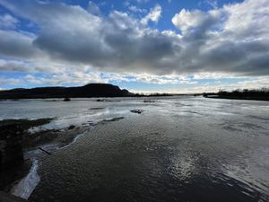
Heavy rain and winds have caused problems for motorists over the last few days, with some roads only passable with care, long queues and extended journeys.
In Shropshire, hours of rain, snow and sleet blocked drains and left pools of standing water covering carriageways. And temporary lights on the main A5 near Shottaton, between Shrewsbury and Oswestry were not helping matters with some drivers turning around to find alternative routes rather than sit in the queues. Shrewsbury-bound traffic was backed up to the Queen's Head turn-off yesterday.
There were several large puddles across the A5 and on roads in Shrewsbury such as Smithfield Road, where flooding is expected to worsen. Social media footage showed at least one Shrewsbury driver persevering through water that reached their bonnet.
A flood alert for the River Severn in the county has been raised by the Environment Agency until at least Monday night, with Bridgnorth at the risk of flooding until Wednesday. The river is expected to peak at Shrewsbury and Ironbridge on Tuesday.
The alert said river levels are rising at Shropshire's Crew Green, Buildwas and Bridgnorth river gauges following recent heavy rainfall. Other areas affected include roads adjacent to the river from Shrewsbury to Upper Arley, Hayes Basin, White Abbey, Leighton, Coalbrookdale, Ironbridge, Bridgnorth and Gravel Hill Lane, Shrewsbury.
It said: "With further heavy rain forecast for the next 24 hours river levels are expected to remain high over the next few days with the possibility of further rises today and into Monday. We are closely monitoring the situation. Our incident response staff are checking defences. Please avoid contact with flood water."
Flood barriers have been installed at Ironbridge and Shrewsbury where the river levels are expected to rise over the next few days.
Further flood warnings have been issued in Vyrnwy at Maesbrook, Melverley and Llanymynech.
It includes the B4398 near canal at New Bridge, Llanymynech and the A483 between Llanymynech & Four Crosses, south of Llanymynech Bridge.
Strong winds are expected across the country throughout Sunday and Monday.
The Met Office said: "Some damage to buildings, such as tiles blown from roofs, could happen, along with trees/branches being brought down.
"Road, rail, air and ferry services may be affected, with longer journey times and cancellations possible; some roads and bridges may close.
"Power cuts may occur, with the potential to affect other services, such as mobile phone coverage.
"Injuries and danger to life could occur from large waves and beach material being thrown onto sea fronts, coastal roads and properties."
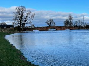
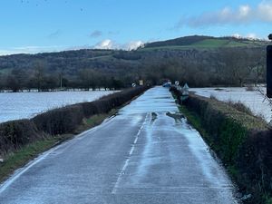
Meanwhile in Llandrinio, over the Welsh border in Powys, motorists are still trying to access the closed B4393 road despite rising water levels. Malcolm Turner, who runs the nearby Grantley Court caravan park, took pictures of the flooding, which has caused tailbacks and disruption all weekend.
Nationally the Met Office has issued an amber warning for wind in Northern Ireland, likely to cause power cuts and potential risk to life and property until 7am on Monday with milder yellow warnings for wind covering Wales, Northern Ireland and most of England from midday today until 1pm on Monday. Hundreds of flood alerts have also been issued by the Environment Agency.
Meteorologist Becky Mitchell said this is the first time the national forecaster has recorded three major storms in such quick succession since the naming system was introduced seven years ago.
She told the PA news agency: "This is the first time we have had three named storms within a week, and we started the storm naming system in 2015.
"At the moment we've got a really active jet stream, which is why we're seeing so many storms track right towards the UK.
"We had Dudley on Wednesday, Eunice on Friday and Franklin today."
It comes just two days after Storm Eunice caused what providers believe was a record national outage over a 24-hour period on Friday, with around 1.4 million homes affected.
Some 83,000 people were still without power on Sunday morning, according to the Energy Networks Association.
To check the latest situation nationally, go to check-for-flooding.service.gov.uk.

