Killer Storm Ophelia expected to bring further disruption to UK
Two men and a woman were killed in separate incidents in the Republic of Ireland.

Storm Ophelia is expected to cause further disruption after three people died in hurricane-force winds and hundreds of thousands were left without power.
Scotland is braced for gusts of up to 70mph and flood warnings are in place on its west coast as the remnants of the hurricane batter the British Isles.
Ireland experienced the worst of the weather on Monday, with winds of almost 100mph damaging electricity networks and causing widespread disruption.
In Cahir, Co Tipperary, a man in his 30s was killed in a chainsaw accident when he was trying to clear a tree downed by the wind.
Earlier, a woman driver in her mid 50s died when a tree fell on her car in strong winds near Aglish village in Co Waterford.

Prime Minister Theresa May spoke to Irish counterpart Leo Varadkar on Monday afternoon to offer support to affected areas.
A Downing Street spokesman said: “On Storm Ophelia, the Prime Minister expressed her sympathies for the loss of life and said the UK Government stood ready to provide any support if requested.”
Around 330,000 homes and business were still without power on Monday night following the worst storm on record on the island of Ireland.
Help from Northern Ireland and the rest of the UK is expected to be drafted in on Wednesday to help restore power, ESB, the Republic of Ireland’s electricity network, said.
Authorities in the Republic and Northern Ireland have said schools will remain closed on Tuesday to ensure the safety of staff and children.
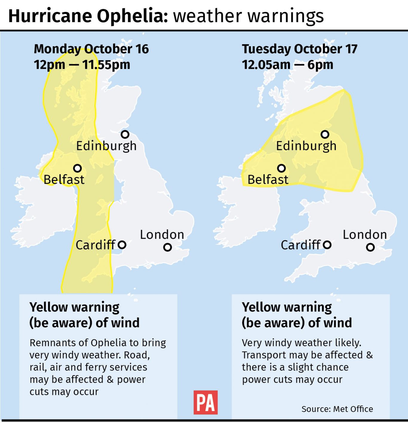
The storm will track north overnight and could cause rush hour disruption in Scotland and northern parts of England, the Met Office said.
A yellow weather warning for wind covering Northern Ireland, southern and central Scotland, the north of England and north west Wales is in place until the morning.
Forecaster Steven Keates said commuters should expect “very gusty conditions”, with winds of up to 70mph.
He said: “The strong winds will continue but should moderate a little bit compared to what we have seen throughout the course of today.
“There’s still a risk of gales and it’s still strong enough to cause disruption, but a little bit down on what we have seen.”

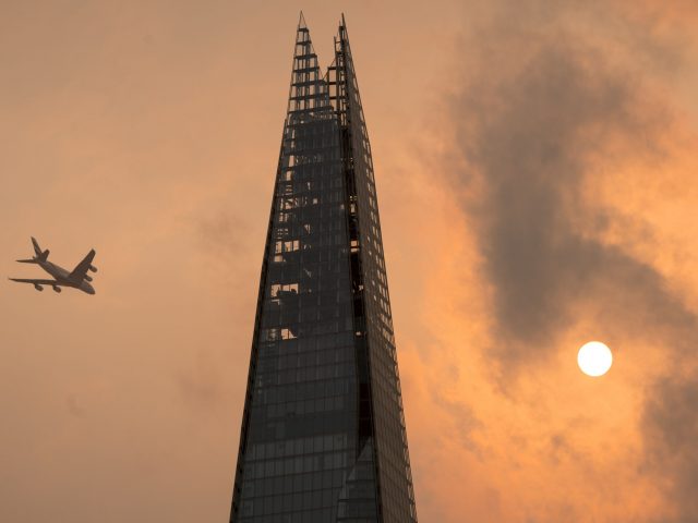
The sun turned red over parts of England on Monday as ex-hurricane Ophelia pulled up air and dust from southern Europe and Africa.
But the phenomenon is unlikely to return on Tuesday due to a change in air mass.
Mr Keates said: “Whereas this morning the air mass was coming up from the south, picking up the smoke from Portuguese wild fires and Saharan dust, now the wind is coming in from the west.
“So it is a much cleaner air mass coming off the ocean.”
Temperatures are also expected to be cooler, after a warm 23.5C (74F) was recorded in Kent on Monday.


